FPV simulator · runs in the browser

Today we fly
Paris.

A drone simulator over a 3D map of the whole planet. Type a city, a landmark or an address, or paste a Google Maps link, and you take off right there, in anything from a camera drone to an FPV quad.

Coming soon See more Play Chrome or Edge on a desktop. Keyboard, gamepad, or your radio over USB.
LOCEiffel Tower, Paris POS48.8537° N  2.2998° E AGL190 m MODECAMERA · GPS HOLD
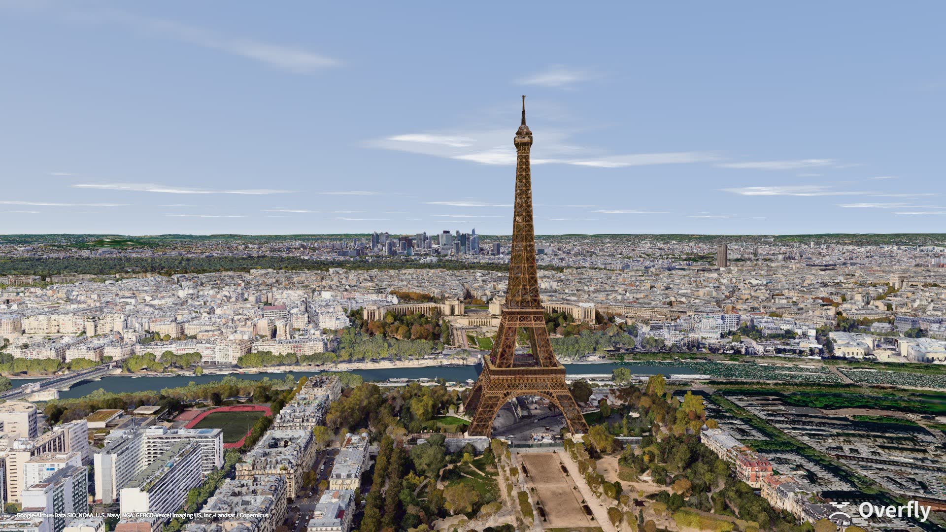
Overfly screenshot: the Eiffel Tower seen from a drone above the Champ de Mars, Paris
Eiffel Tower · Paris48.8537 N · 2.2998 E · 190 m
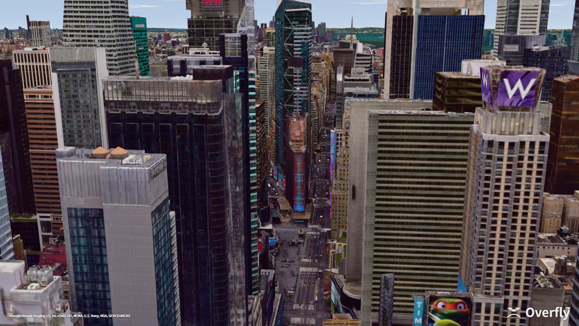
Overfly screenshot: the billboard canyon of Times Square seen from above Seventh Avenue, New York
Times Square · New York40.7608 N · 73.9838 W · 195 m
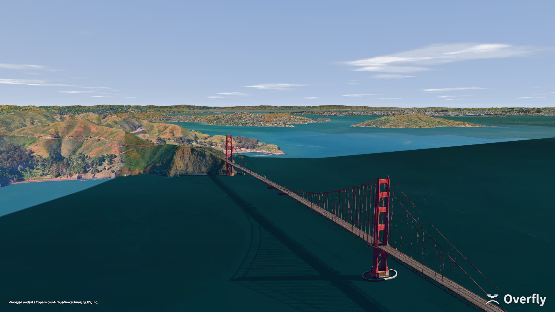
Overfly screenshot: the Golden Gate Bridge, San Francisco
Golden Gate · San Francisco37.8080 N · 122.4830 W · 382 m
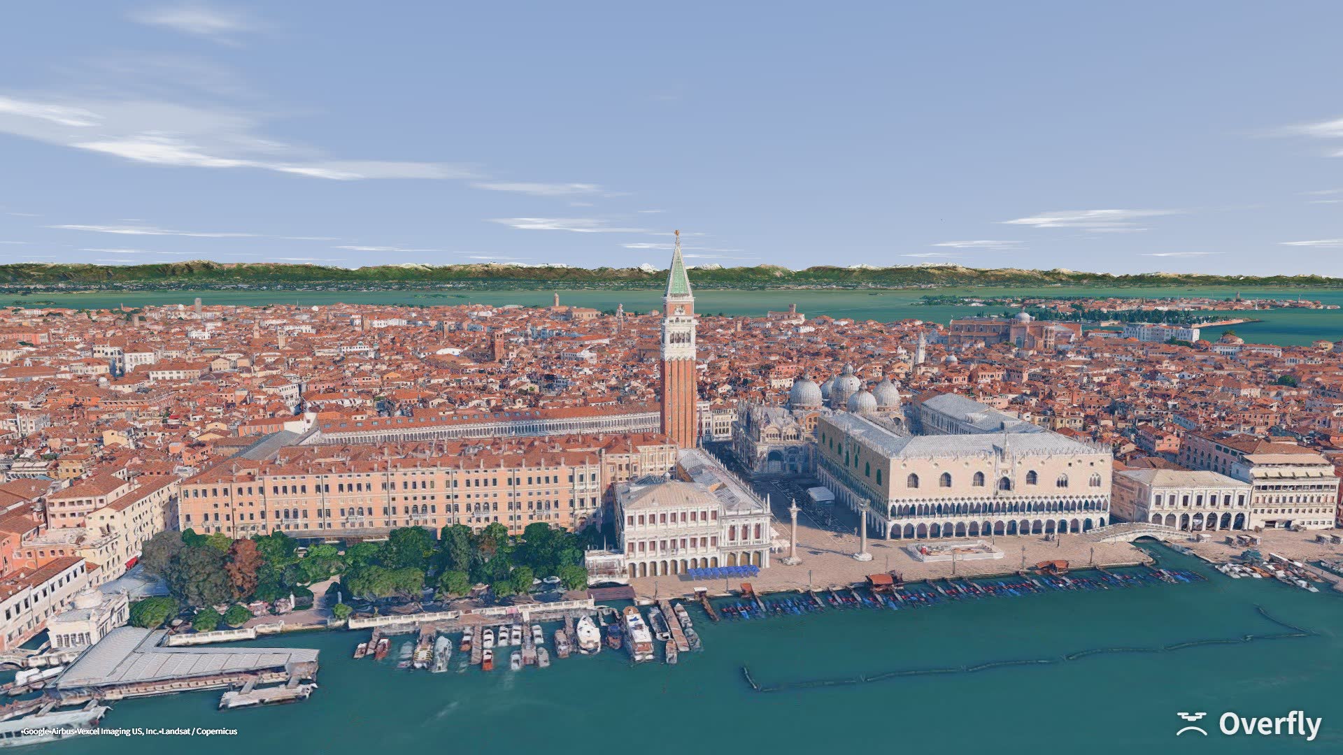
Overfly screenshot: St Mark's Square and the lagoon, Venice
St Mark's Square · Venice45.4313 N · 12.3397 E · 80 m
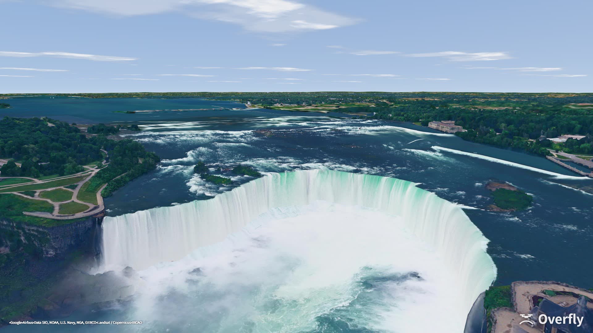
Overfly screenshot: Horseshoe Falls at Niagara seen from above the gorge
Niagara Falls · Canada43.0808 N · 79.0786 W · 106 m
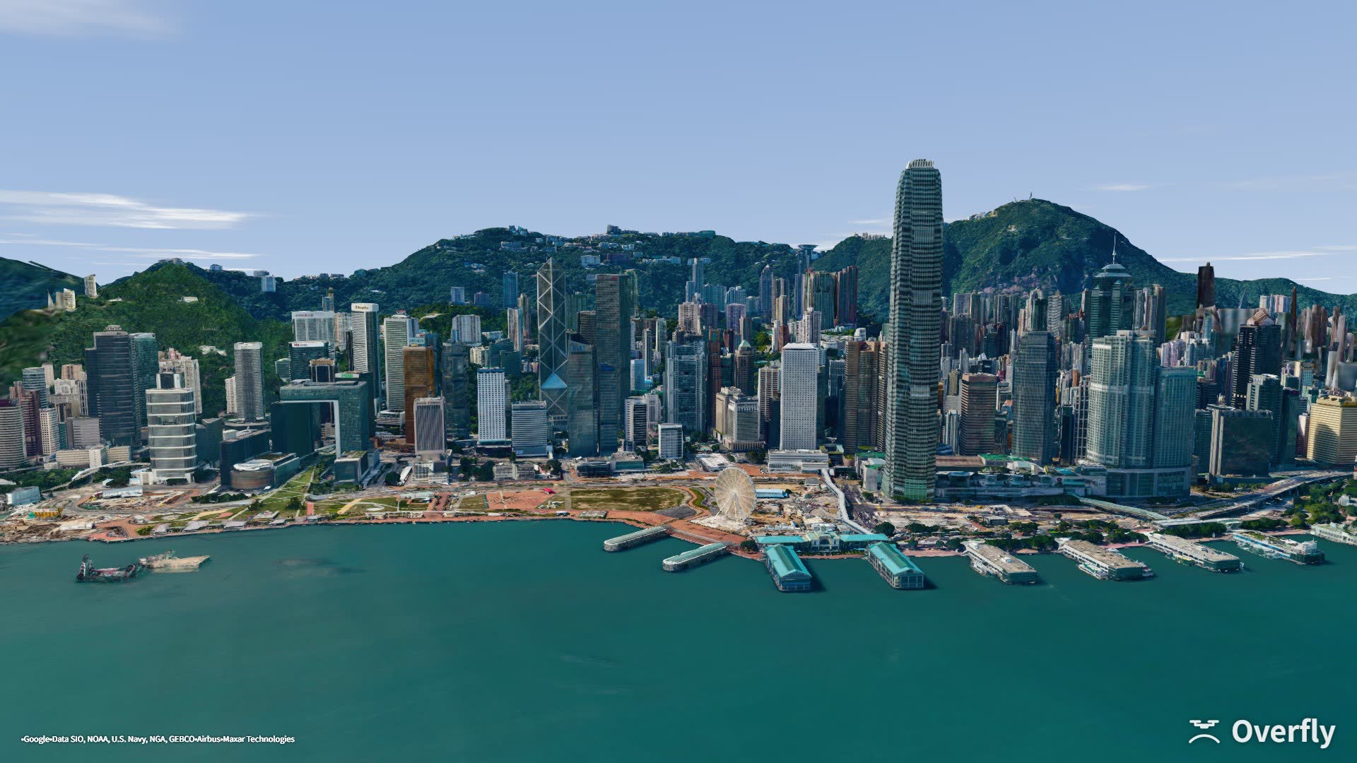
Overfly screenshot: Victoria Harbour and the hills behind Hong Kong Island
Victoria Harbour · Hong Kong22.2920 N · 114.1660 E · 250 m
Places

From the park down the road
to the landmarks of the world.

34 landmarks are one click away, and anywhere else is a search: a place name, coordinates, or a link copied out of Google Maps.

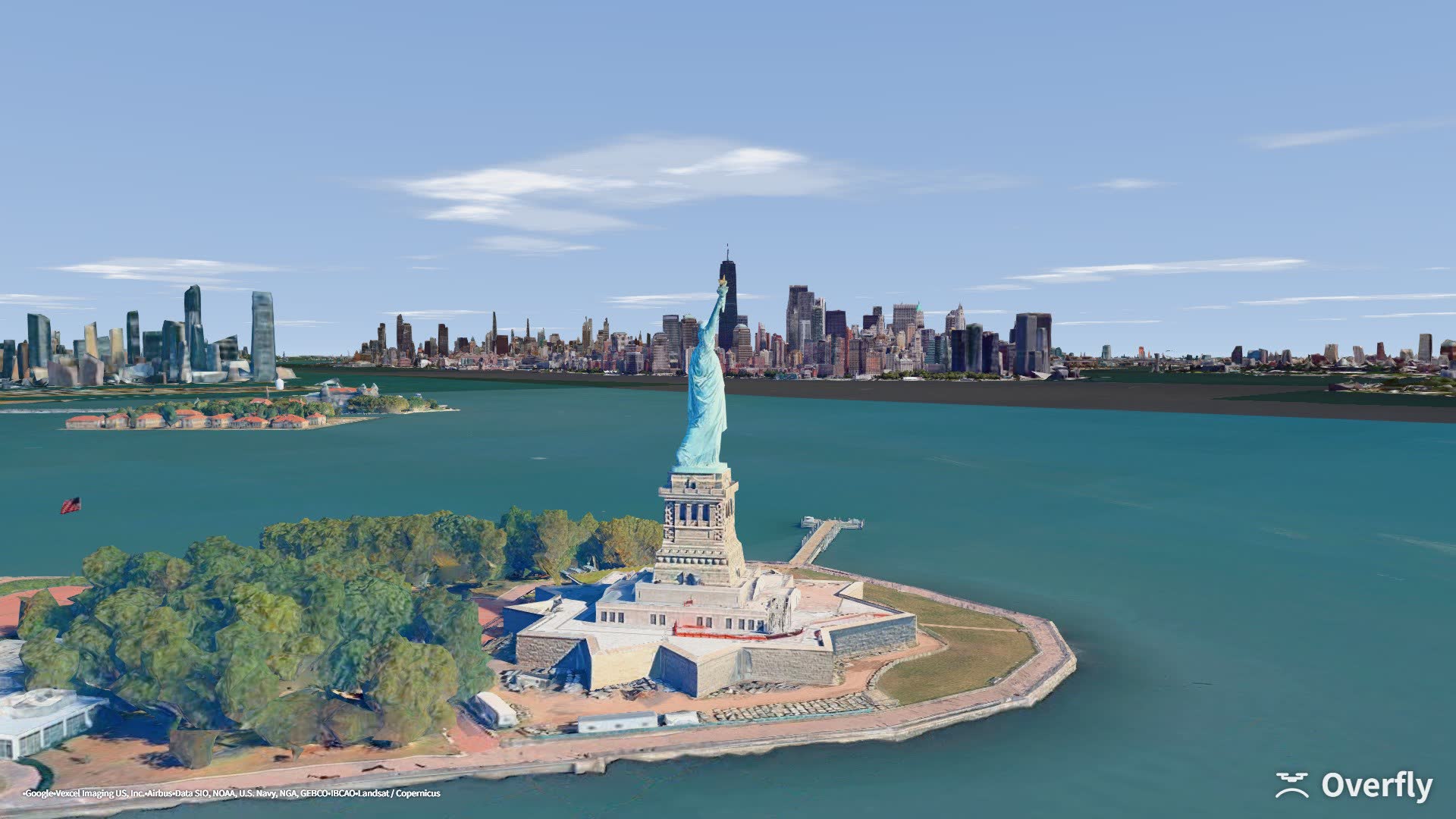
Overfly screenshot: the Statue of Liberty with the Lower Manhattan skyline behind it
New York Harbor · Manhattan40.6876 N · 74.0466 W
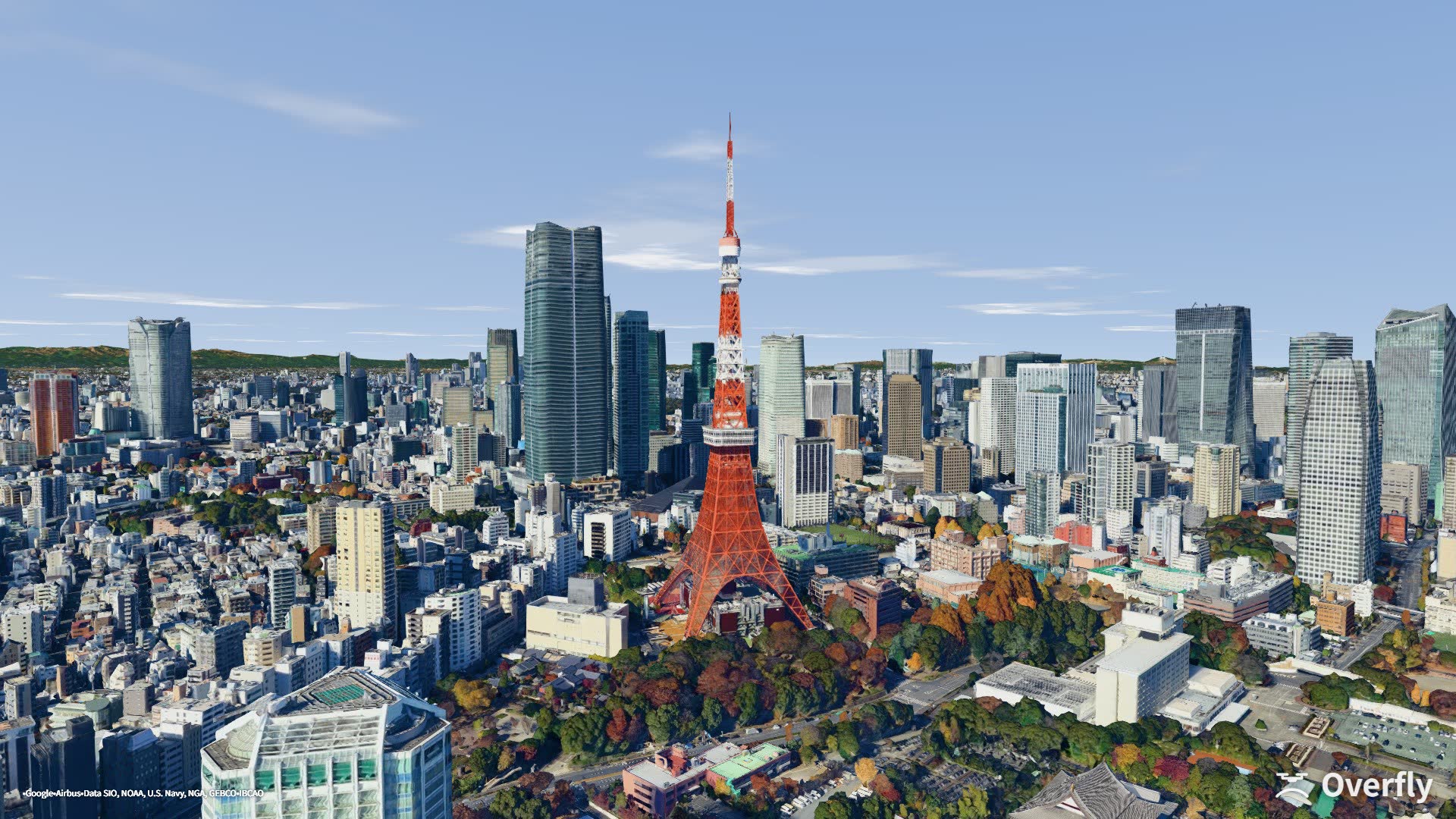
Overfly screenshot: Tokyo Tower rising above the city, seen from the south
Tokyo Tower · Tokyo35.6545 N · 139.7492 E
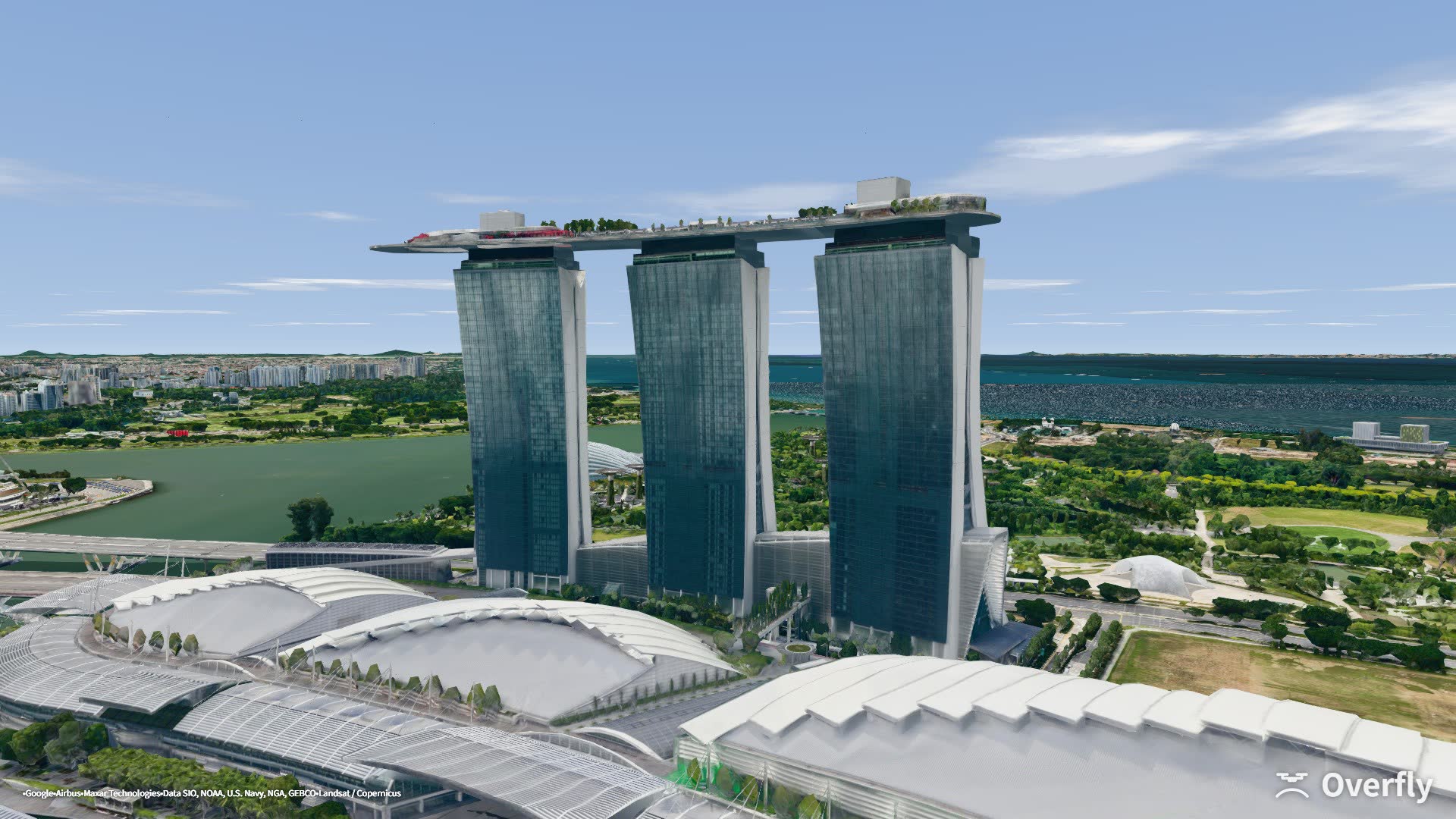
Overfly screenshot: Marina Bay and the Singapore skyline
Marina Bay · Singapore1.2834 N · 103.8567 E
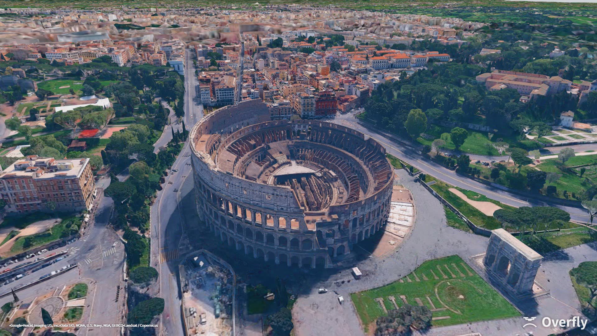
Overfly screenshot: the Colosseum and the Roman Forum
Colosseum · Rome41.8913 N · 12.4898 E
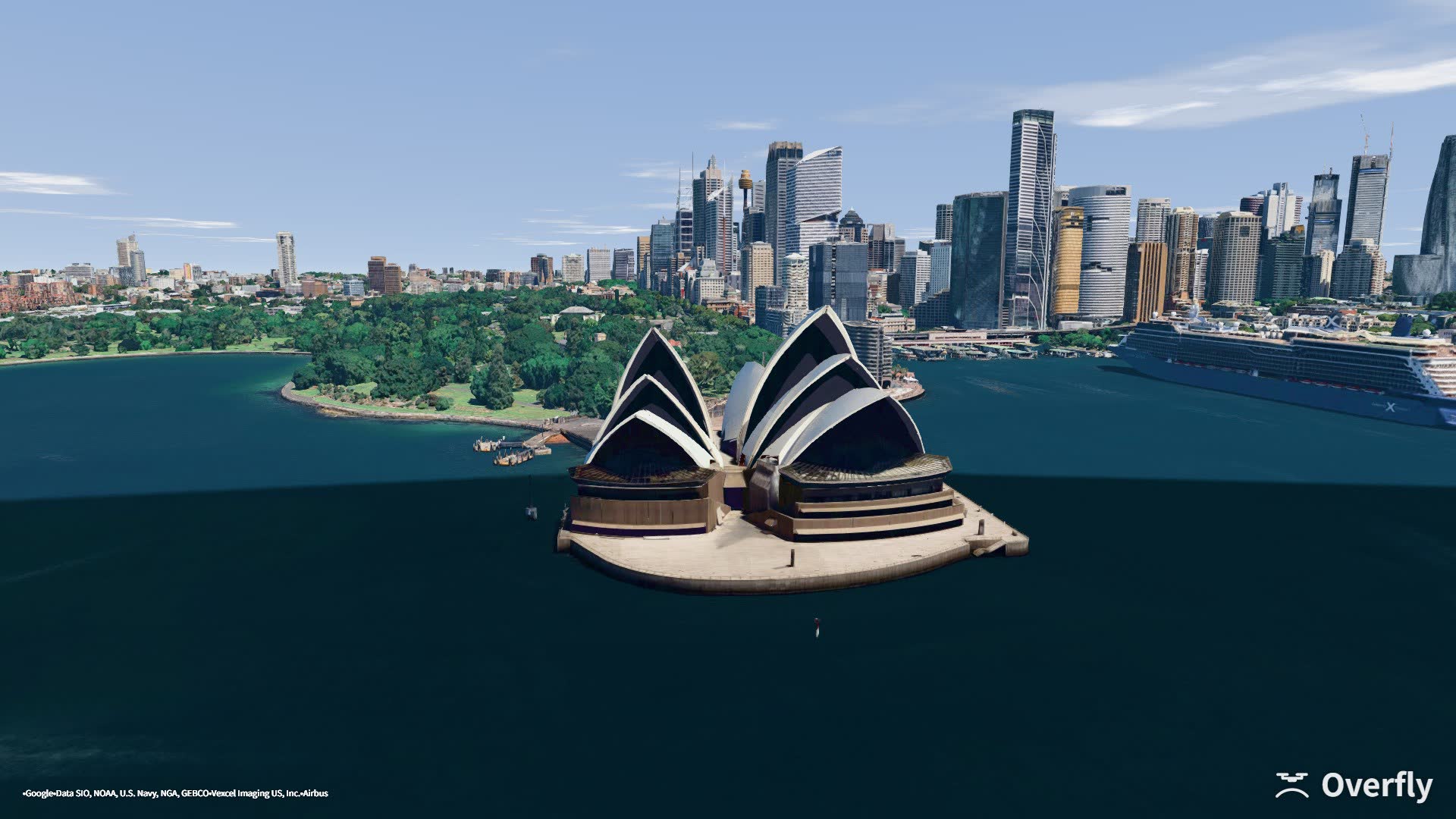
Overfly screenshot: Sydney Opera House from across the harbour
Opera House · Sydney33.8544 S · 151.2163 E
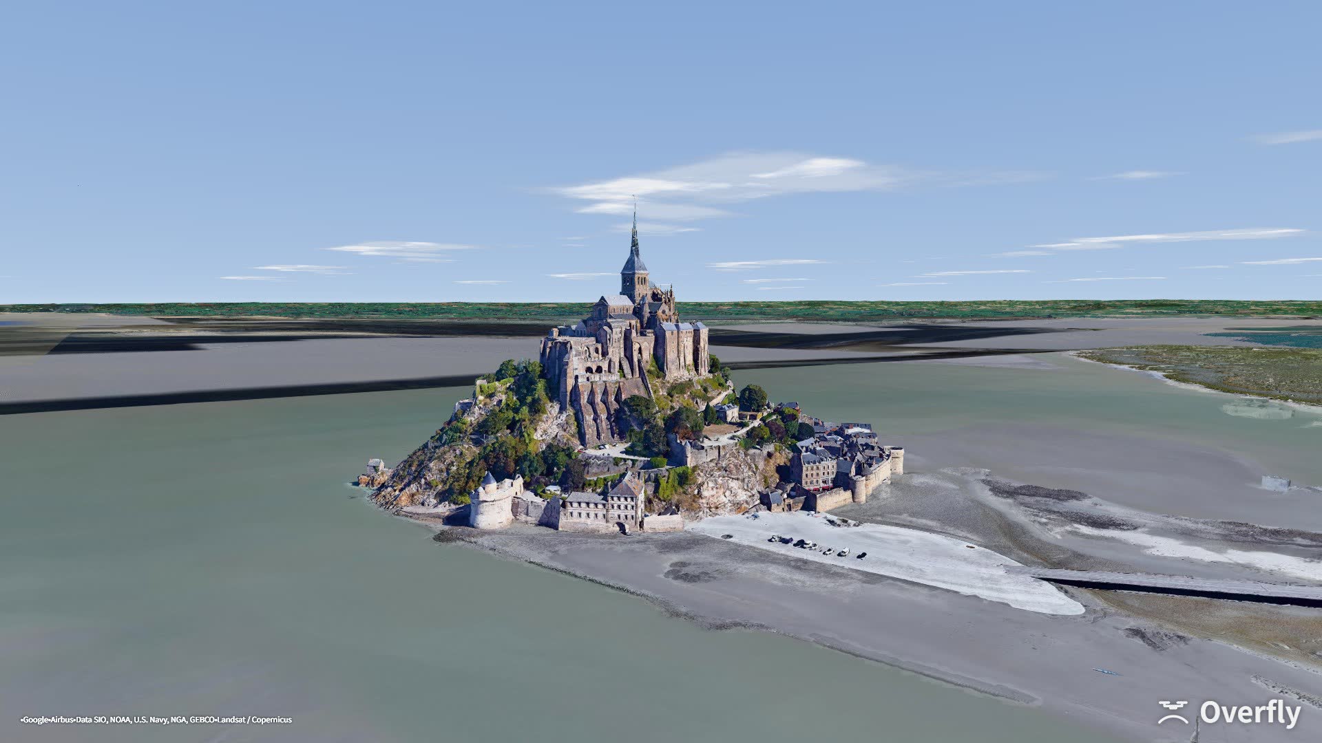
Overfly screenshot: Mont-Saint-Michel at low tide
Mont-Saint-Michel · France48.6327 N · 1.5147 W
Aircraft

Rip it in Acro, or park it on GPS and shoot.

One key switches between them. Fly in GPS, Angle or Acro mode, and give the FPV quad your own build: weight, KV, cell count and prop.

FPV · Acro · Westminster, London51.5007 N · 0.1246 W
FPV

FPV quad

  • Acro, Angle, and 3D mode with reversed props
  • 3-inch cinewhoop, 5-inch freestyle, 7-inch long range
  • Or enter weight, cells, KV and prop, and fly that exact build
  • Prop-wash, ground effect and vortex ring state are modelled
Camera drone · Umeda Sky Building, Osaka34.7053 N · 135.4906 E
Camera drone

GPS camera drone

  • Let go of the sticks and it holds its position
  • Gimbal from −90° to +65° and a smooth zoom up to 7.6×, with composition guides on screen
  • Three sizes, 200 g, 900 g and 4 kg, and each one flies like its weight
  • Waypoint routes and orbits fly themselves while you work the camera
FPV · Acro 3D · Midtown Manhattan40.7505 N · 73.9880 W
FPV · 3D

3D mode: flip it and keep flying

  • Centre stick is zero thrust; below centre the props spin in reverse
  • Hang upside down, fly inverted, and pull out of dives with reverse thrust
  • Switch it on from the flight-mode chip at the top of the screen
Time attack

The course is the line you just flew.

Press B to drop a gate wherever you are. The first one is the start, the last one is the finish. Press N and the clock starts as you cross the start gate. The next gate glows orange, and an arrow points to it when it is off-screen.

Placing gates, then racing them · Eiffel Tower48.8584 N · 2.2945 E
30courses saved, each with its own personal best. Loading one warps you to the start gate.
10mgate diameter. Only the order counts, so you can take a gate from either side.
20actions you can put on a radio switch, including dropping gates and starting the clock.
Weather

Rain beads on the lens. Fog takes your line of sight.

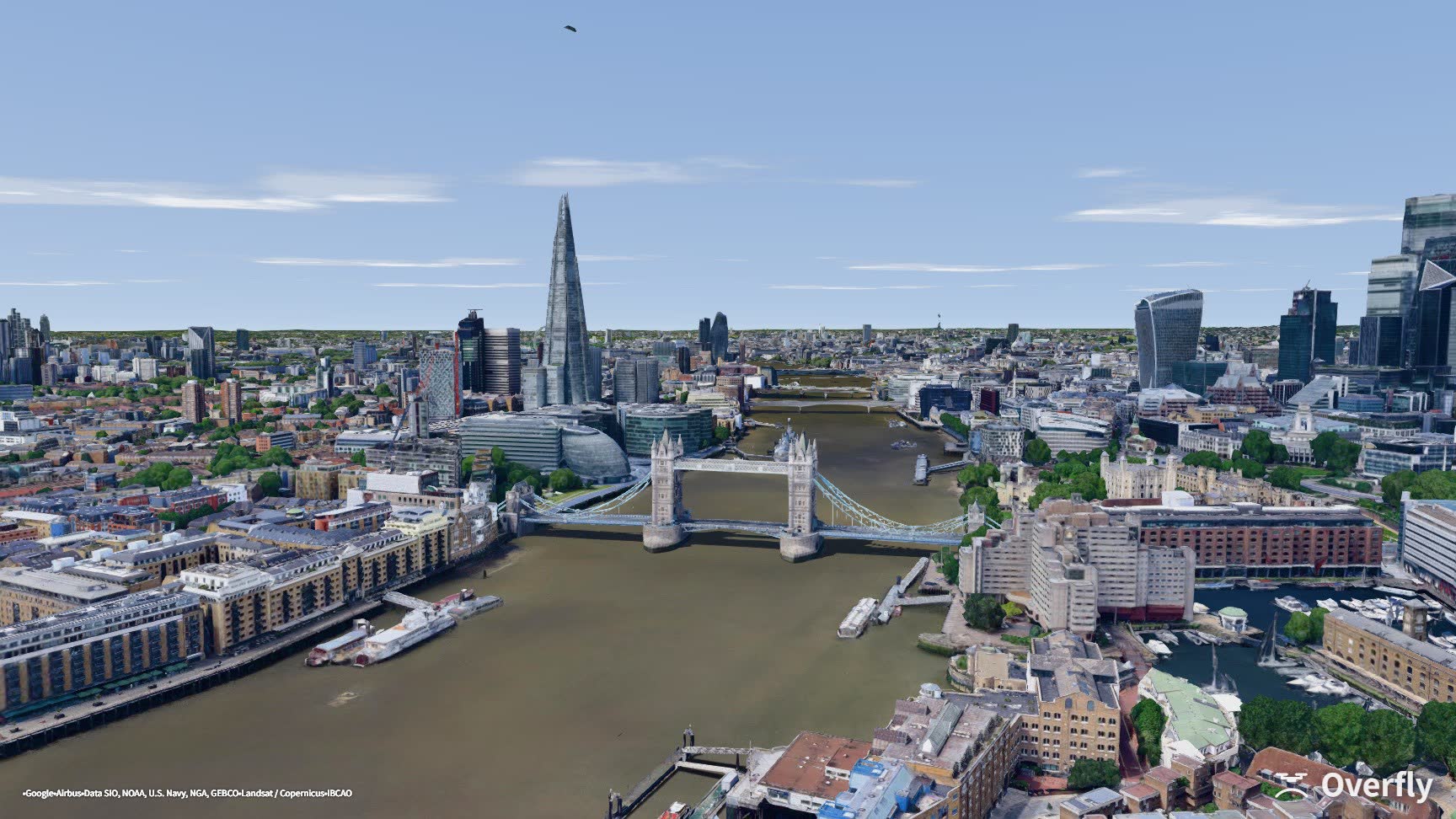
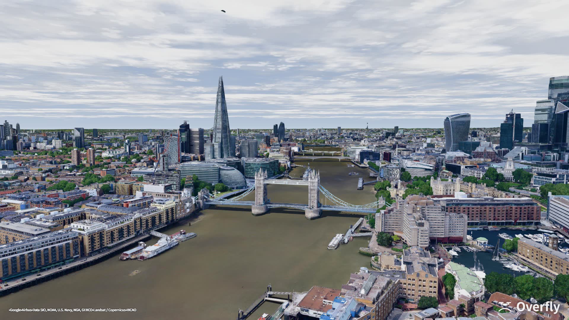
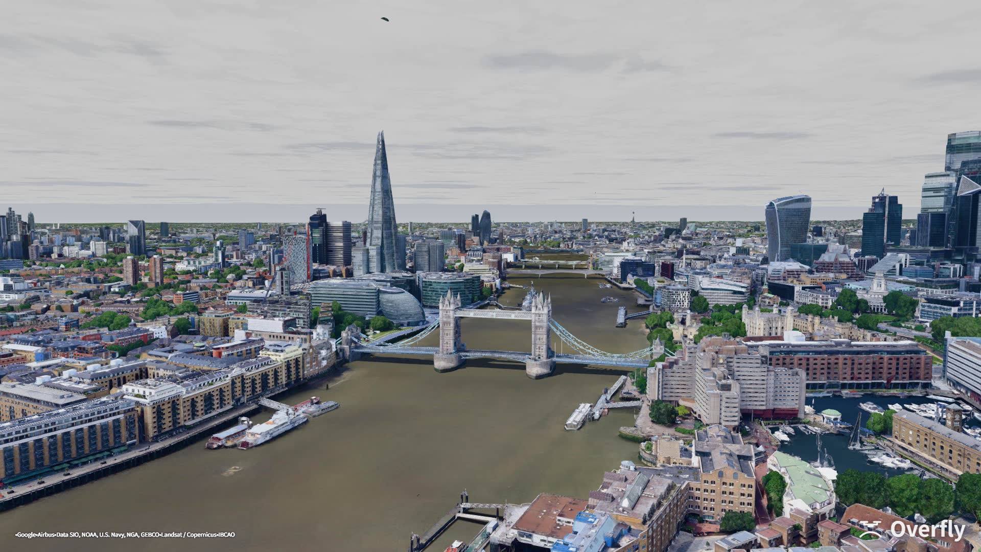
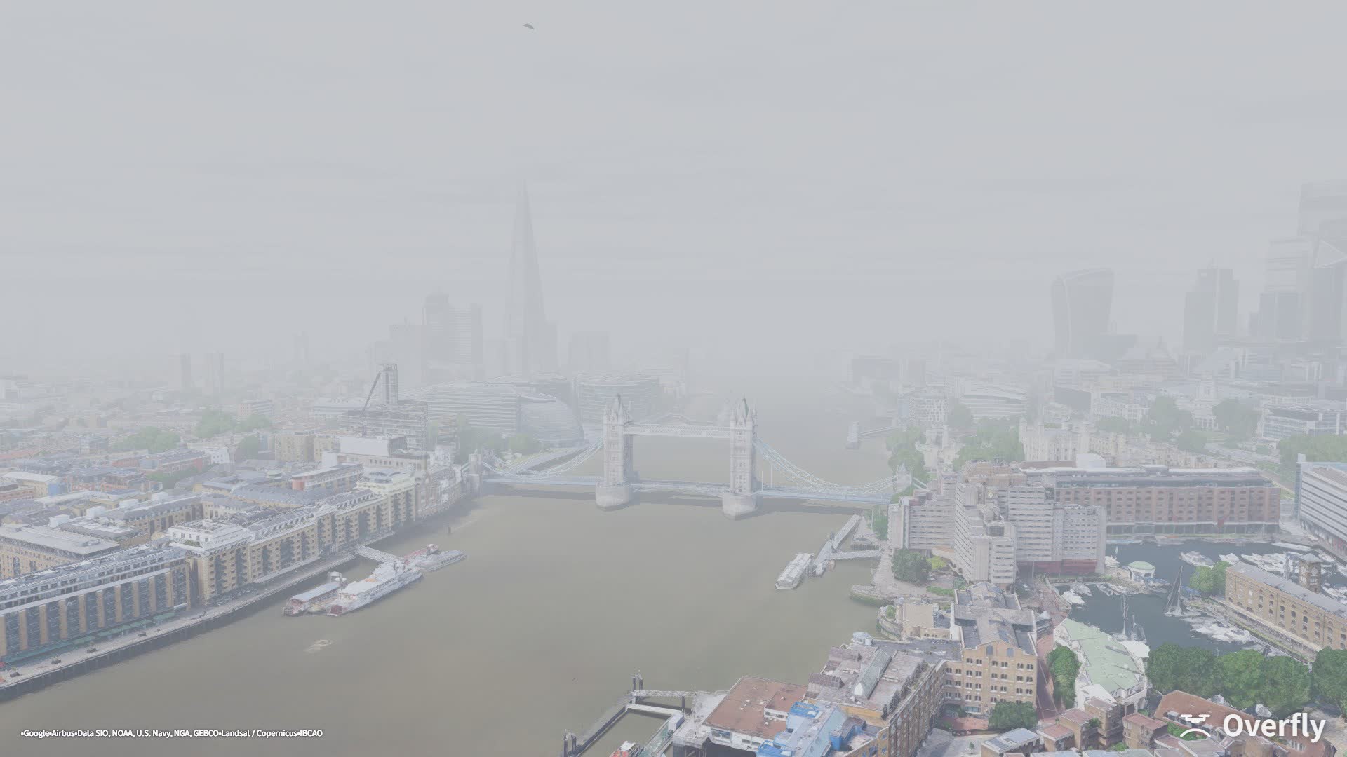
Seven presets, each with its own light, cloud and visibility. Wind is set separately — mean speed, how much stronger it gets with height, turbulence, and how often the gusts come — so you can fly the same conditions as many times as you need.

Overfly screenshot: Tower Bridge under a clear sky
Clear51.5048 N · 0.0675 W
Overfly screenshot: Tower Bridge on a fair day with scattered cloud
Fair51.5048 N · 0.0675 W
Overfly screenshot: Tower Bridge under an overcast sky
Overcast51.5048 N · 0.0675 W
Overfly screenshot: Tower Bridge in fog, the far bank fading to white
Fog51.5048 N · 0.0675 W
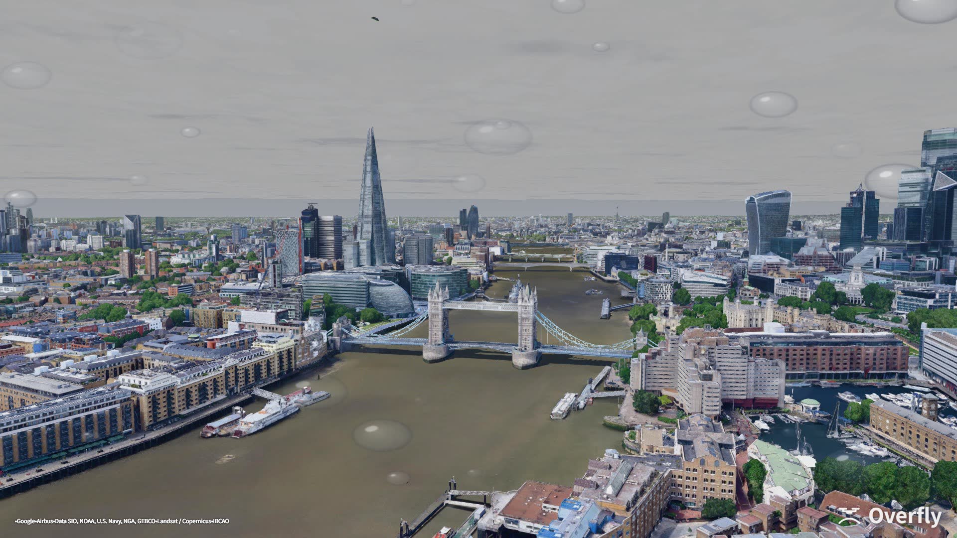
Overfly screenshot: Tower Bridge in rain, with droplets on the camera lens
Rain51.5048 N · 0.0675 W
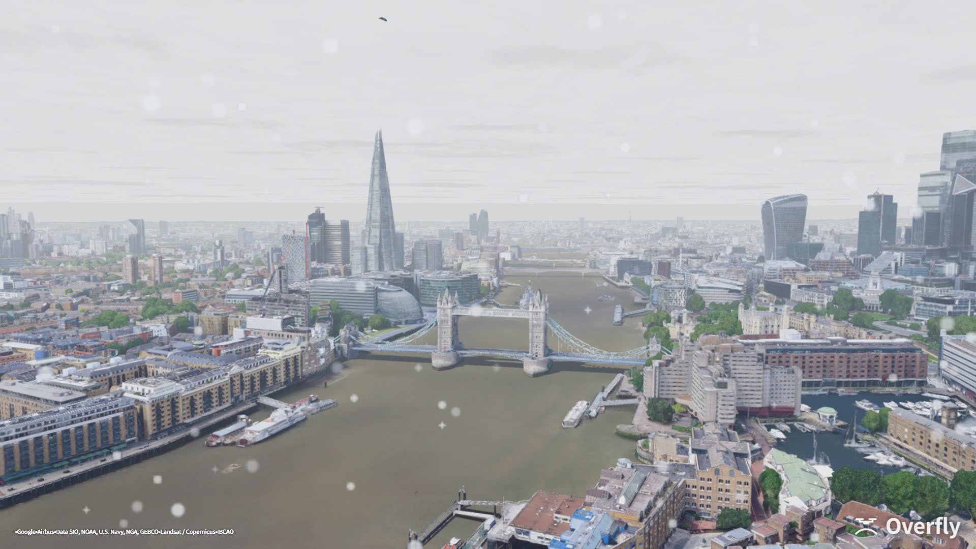
Overfly screenshot: Tower Bridge in snow, flakes on the camera lens
Snow51.5048 N · 0.0675 W
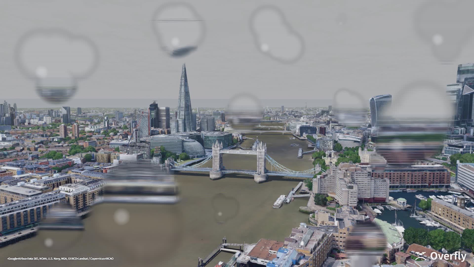
Overfly screenshot: Tower Bridge in a storm, dark cloud and heavy rain
Storm51.5048 N · 0.0675 W
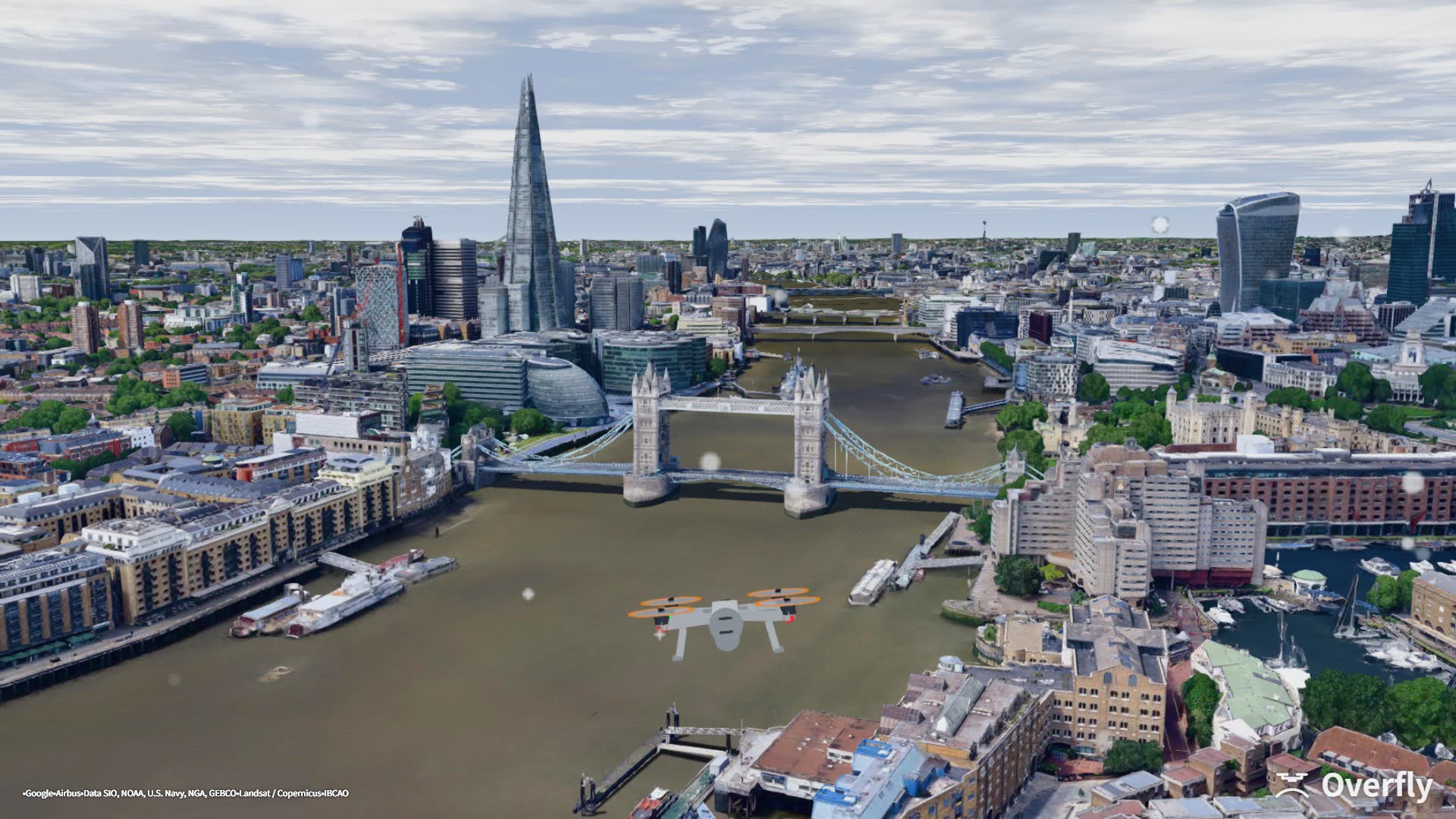
Overfly screenshot: Tower Bridge under a gust warning, the drone leaning into the wind
Gusts51.5048 N · 0.0675 W
Sun

The sun sits where it really would, that day, over that city.

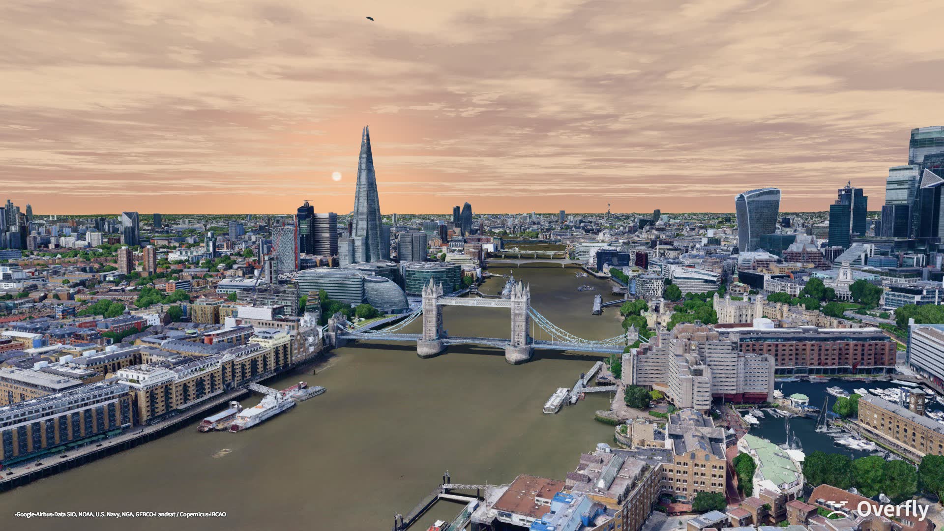
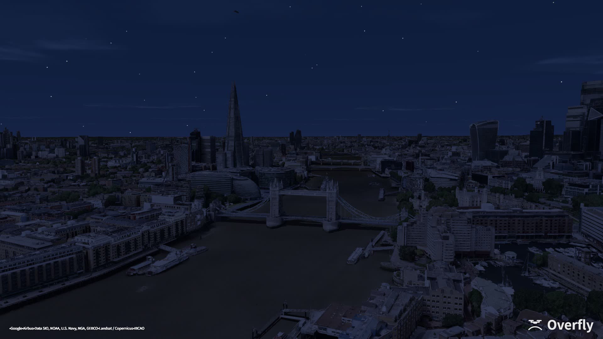
Its position comes from latitude, longitude and date, shown in local time. Pick a December date and London is dark before four; pick June and it is still light after nine. The three frames below look out from above Tower Bridge, with only the time of day changed.

Overfly screenshot: Tower Bridge and the City of London at midday
13:0051.5048 N · 0.0675 W
Overfly screenshot: the same view of Tower Bridge at golden hour
18:30 · golden hour51.5048 N · 0.0675 W
Overfly screenshot: the same view at night under a starfield
22:00 · night51.5048 N · 0.0675 W
Dawn to dusk · Shibuya, Tokyo35.6595 N · 139.7005 E
Settings

The same numbers you would type into Betaflight Configurator.

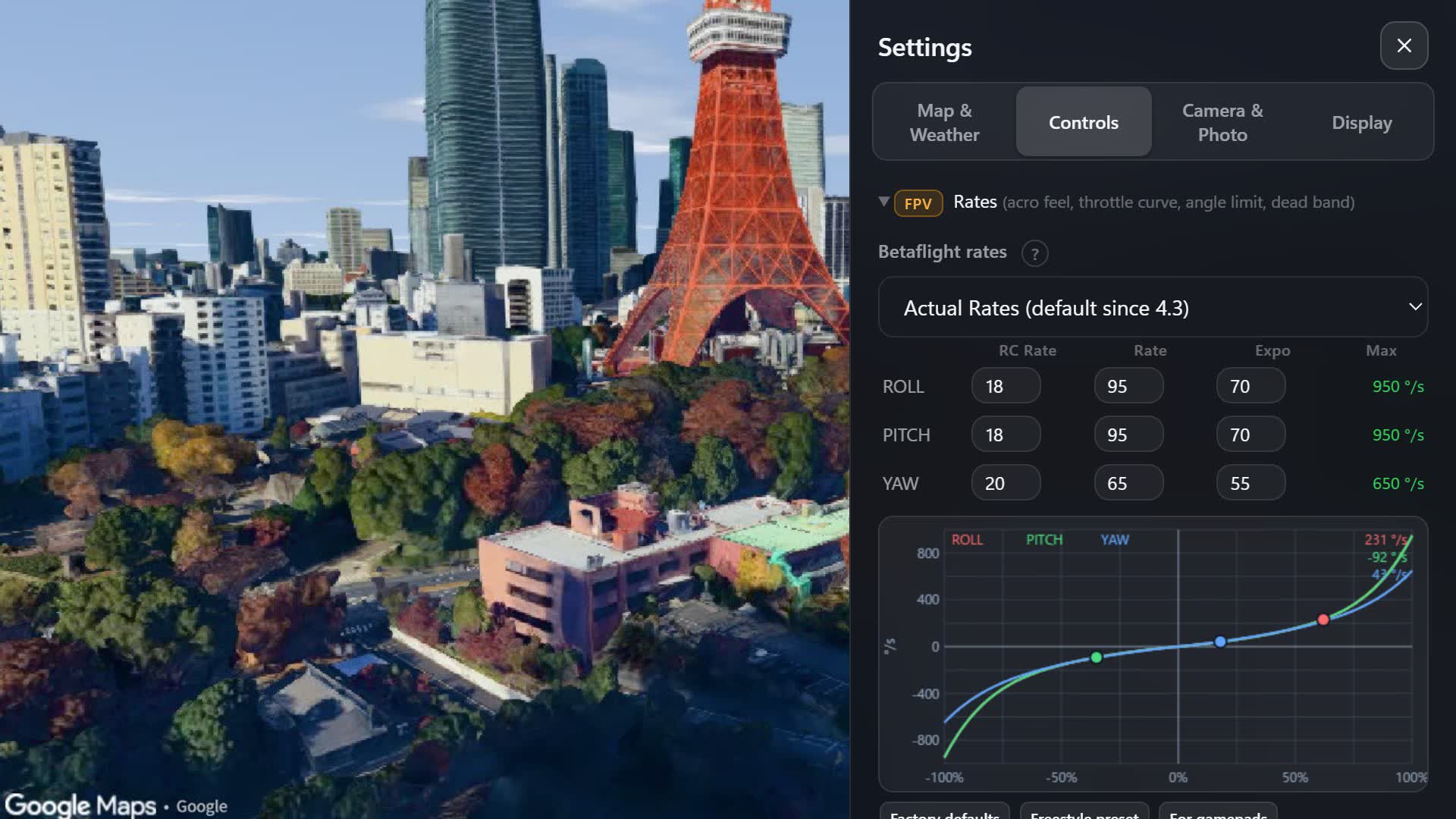
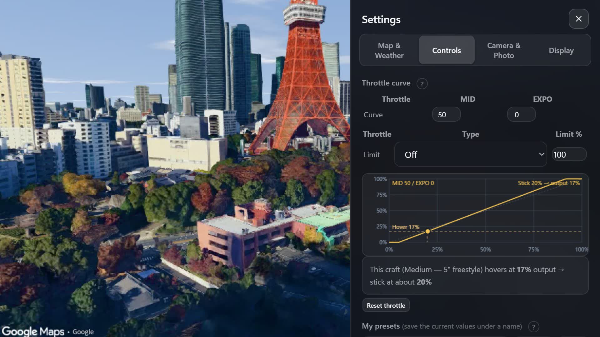
Rates, expo, throttle curve and throttle limit run on Betaflight's own formulas, so values copied from your quad feel the same here. Four screens from the settings panel:

Overfly settings: Betaflight rate table and the rate graph with the current stick position

Rates, with your stick on the graph

Actual or Betaflight rates per axis, drawn across the full −100 to +100 % stick range. The dot is where your stick is right now.

Overfly settings: throttle curve with MID, EXPO and throttle limit, and the hover point of the current quad

Throttle curve and hover point

MID, EXPO and a throttle limit (SCALE or CLIP), as in Betaflight. The graph marks the throttle your quad hovers at and where your stick sits for it.

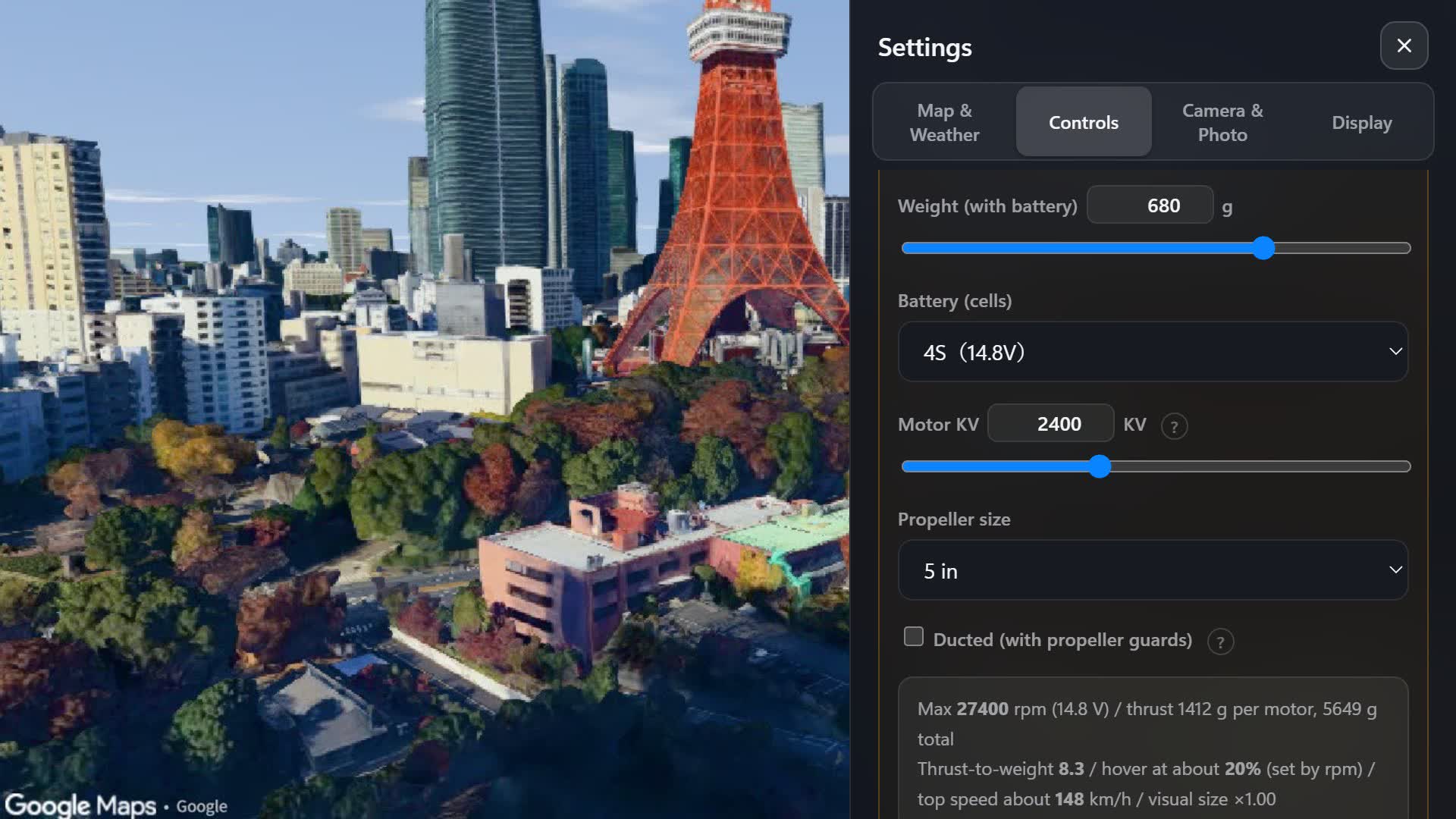
Overfly settings: custom quad from weight, cells, KV and prop size, with the computed thrust and hover throttle

Build your own quad

Weight, cell count, KV and prop size, anywhere from a 31 mm whoop to a 10-inch. Overfly works out thrust, hover throttle and top speed.

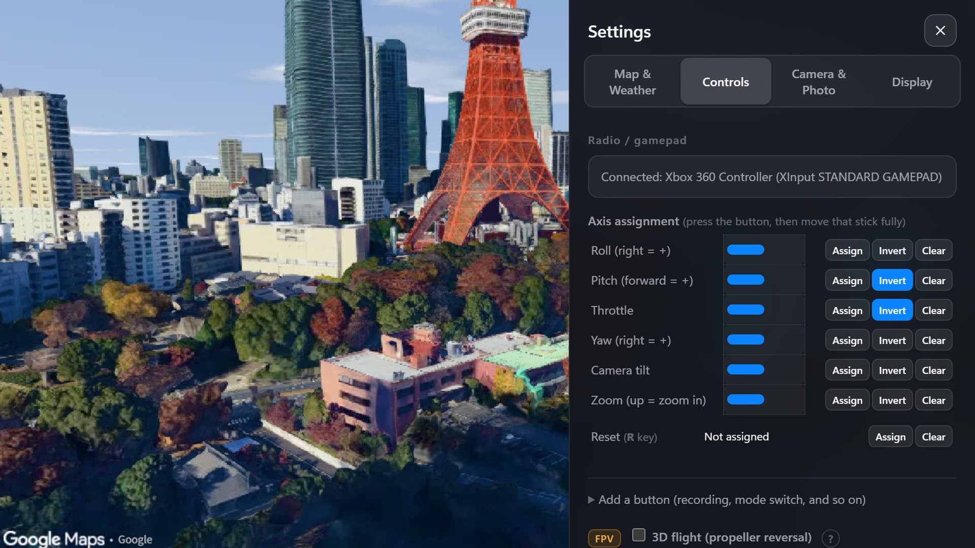
Overfly settings: axis assignment table for a USB radio, with invert and clear buttons

Every axis, every switch

Assign and invert each axis, zoom included, and calibrate its ends. Switches can respawn you, drop gates, start recording and more, or turn the tilt control into zoom while they are held. Radios that send switches as axes work too.

Numbers

Checked against real quads.

The reference build is a 5-inch freestyle quad. Thrust, hover throttle, top speed and drag come from thrust-stand tests, flight reviews and published research.

1000Hz
Fixed physics step, independent of frame rate
17%
Hover throttle at a thrust-to-weight of 10
670°/s
Full-stick rate on the Actual Rates defaults
×4.3
Vertical drag against forward — why pitching up brakes
Terminal velocity, vertical≈ 15 m/s
Motor response, spin-up / spin-down25 ms / 35 ms
Angle-mode levelling, from 30°< 1° after one second, both axes
Thrust at half throttle≈ 39 % of full (thrust stands measure 37 %)
Top speed, 5-inch 6S freestyle≈ 165 km/h
Local time and altitudeIANA time zones · EGM96 geoid
Also on board

What's on the other keys.

A photo taken with Overfly's photo mode: the Eiffel Tower

Photo and video PV

Stills, and clips with the motor sound, recorded straight from the browser. The map attribution and a small Overfly mark are burned into every frame, so you can post them wherever you like.

Ghost replay KL

Record a run and fly against it. Or switch to the camera drone and film your own FPV line as the subject.

Waypoints and orbit

Mark points as you fly and the camera drone flies the route by itself, while yaw and gimbal stay in your hands. Or pick a subject in the middle of the frame and it circles it, nose in; roll sets direction and speed.

Minimap

Your track, the home point, waypoint routes and orbit circles on a live map in the corner of the screen.

Real elevation, and a ceiling

The HUD shows height above take-off, above the ground below you, and above sea level. Turn on the altitude limit and you hit an invisible ceiling at the legal height — 150 m in Japan, 400 ft in the US — or at any height you choose.

Aerial drill T

Planes, aerobatic planes and boats move through the scene. Keep one framed for 60 seconds and you get a score.

Price

A year of unlimited flying for $34.

One payment. It never renews itself and never asks for your card again.

1-year licence
$34 per year · one-time payment
  • Every place on Earth, unlimited flying
  • All flight modes, weather and controller features
  • Valid for 12 months, then it simply ends — never auto-renews
  • No account to create, no cookie banner
Coming soon Sales open shortly

Sold and billed by Polar Software Inc. Price in USD; local taxes may apply at checkout. See the terms for details.

From purchase to first flight

Five steps to the sky.

The game lives here play.getoverfly.com

Chrome or Edge on a desktop or laptop. Bookmark it — this is where you fly every time.

Open Overfly
01

Buy a licence

Press Buy a licence. Checkout is run by Polar: enter your email and pay by card. $34, once.

02

Copy your licence key

The key appears on the page right after payment. Copy it. Lost it? Open View order in the email from Polar to see it again.

03

Open the game

Go to play.getoverfly.com in Chrome or Edge. Nothing to install, no account to make.

04

Paste the key

Press Start, paste the key into License key and press Apply. The browser remembers it, and one key works on up to three devices at a time.

05

Pick a place and fly

Choose a landmark or search any place, then press Start flying. Fly with the keyboard (W S and the arrow keys) or your radio over USB. R puts you back at the start.

FAQ

Before you buy

What do I need to run it?

A desktop or laptop with a recent Chrome or Edge and a GPU that handles WebGL 2 — most machines from the last few years do. Phones and tablets can fly with on-screen sticks too.

Which controllers work?

Anything the browser sees as a gamepad: FPV radios in USB joystick mode (RadioMaster, BetaFPV, Jumper…), Xbox and PlayStation pads. You assign and invert axes on the start screen and can map switches to actions like recording or mode changes. DJI camera-drone controllers (RC-N1, RC-N2, RC-N3, Smart Controller, RC 2, RC Pro 2) also connect over USB, as an experimental feature.

How do I connect a DJI controller?

This is experimental and needs Chrome or Edge on a computer. Turn the controller on and connect it with a USB cable that carries data.

  1. RC-N1, RC-N2, RC-N3, DJI Smart Controller: in Settings → Controls, open Connect a DJI controller, press RC-N1 / N2 / N3 / Smart Controller and pick the entry marked “V1”.
  2. RC 2, RC Pro 2 on Windows, once per computer: download the free tool Zadig and open it with the controller plugged in.
  3. In Zadig, open Options ① and check List All Devices ②.Zadig: open Options and check List All Devices
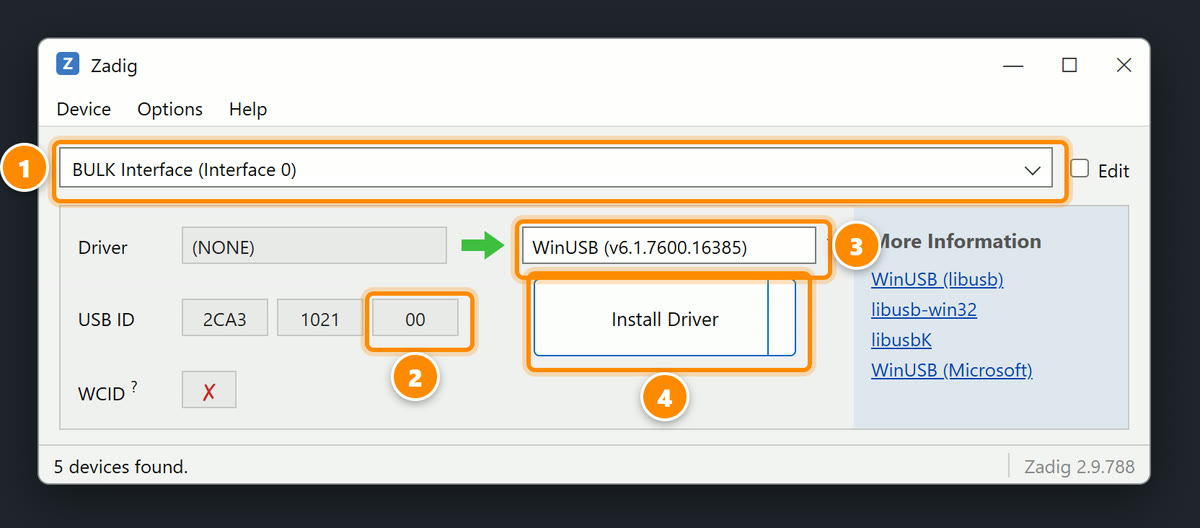
  4. Open the list at the top and choose BULK Interface (Interface 0) ①. The third box of its USB ID reads 00 ②; don’t choose “MTP” (that one reads 01). Set the box on the right to WinUSB ③ and press Install Driver ④ (or Replace Driver). When it reports success, unplug the controller and plug it back in.Zadig: BULK Interface (Interface 0), USB ID ending in 00, WinUSB, Install Driver
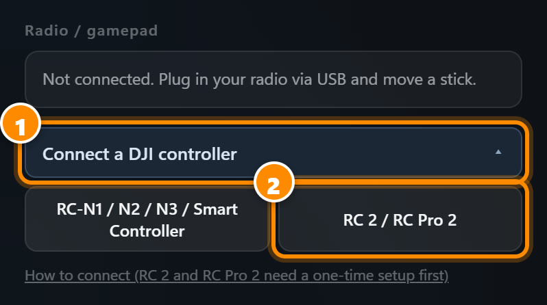
  5. RC 2, RC Pro 2: in Settings → Controls, open Connect a DJI controller ①, press RC 2 / RC Pro 2 ② and pick your controller.Overfly settings: Connect a DJI controller, then RC 2 / RC Pro 2

The steps are the same for RC 2 and RC Pro 2. If you put WinUSB on “MTP” by mistake, the controller’s files stop showing up in File Explorer: in Device Manager, uninstall that device with the box to delete its driver ticked, then plug the controller back in.

Both sticks and the camera dial work, and on RC 2 and RC Pro 2 the right dial zooms. The other buttons can’t be read. A DJI update may stop this from working.

Can I play offline?

No. The scenery streams in from the internet while you fly, so you need a connection. Your licence is also checked online when the game starts.

Can I try it before I buy?

No. Overfly streams map data that costs real money on every launch, so there is no trial version. Refunds are available within a limited number of launches and a limited period after purchase; the conditions are set out in the terms.

Do you collect my data?

There is no account, and the game never asks for your email; Polar needs one at checkout to send your receipt. Your settings live in your own browser. The details are in the privacy policy linked below.
News

What's new

Our first video: nine cities in 80 seconds

A quick look at what Overfly can do: a dive down the Empire State Building, the Eiffel Tower to Shibuya Crossing, freestyle FPV over Nishi-Shinjuku, a GPS camera drone circling the Colosseum, and the same flight at three times of day and in three kinds of weather. Every shot was flown in Overfly. More clips are on YouTube, TikTok and Instagram.

Fly with a DJI controller (experimental)

Overfly can now read DJI camera-drone controllers over USB: RC-N1, RC-N2, RC-N3, the DJI Smart Controller, RC 2 and RC Pro 2. Turn the controller on, plug it in and press the matching DJI button in the controller settings. Both sticks and the camera dial work, and on RC 2 and RC Pro 2 the right dial zooms. The other buttons can't be read. This support is experimental: it doesn't use an official DJI interface, so a DJI update may stop it working. You need Chrome or Edge on a computer, and on Windows the RC 2 and RC Pro 2 need a one-time driver setup, explained under the button.

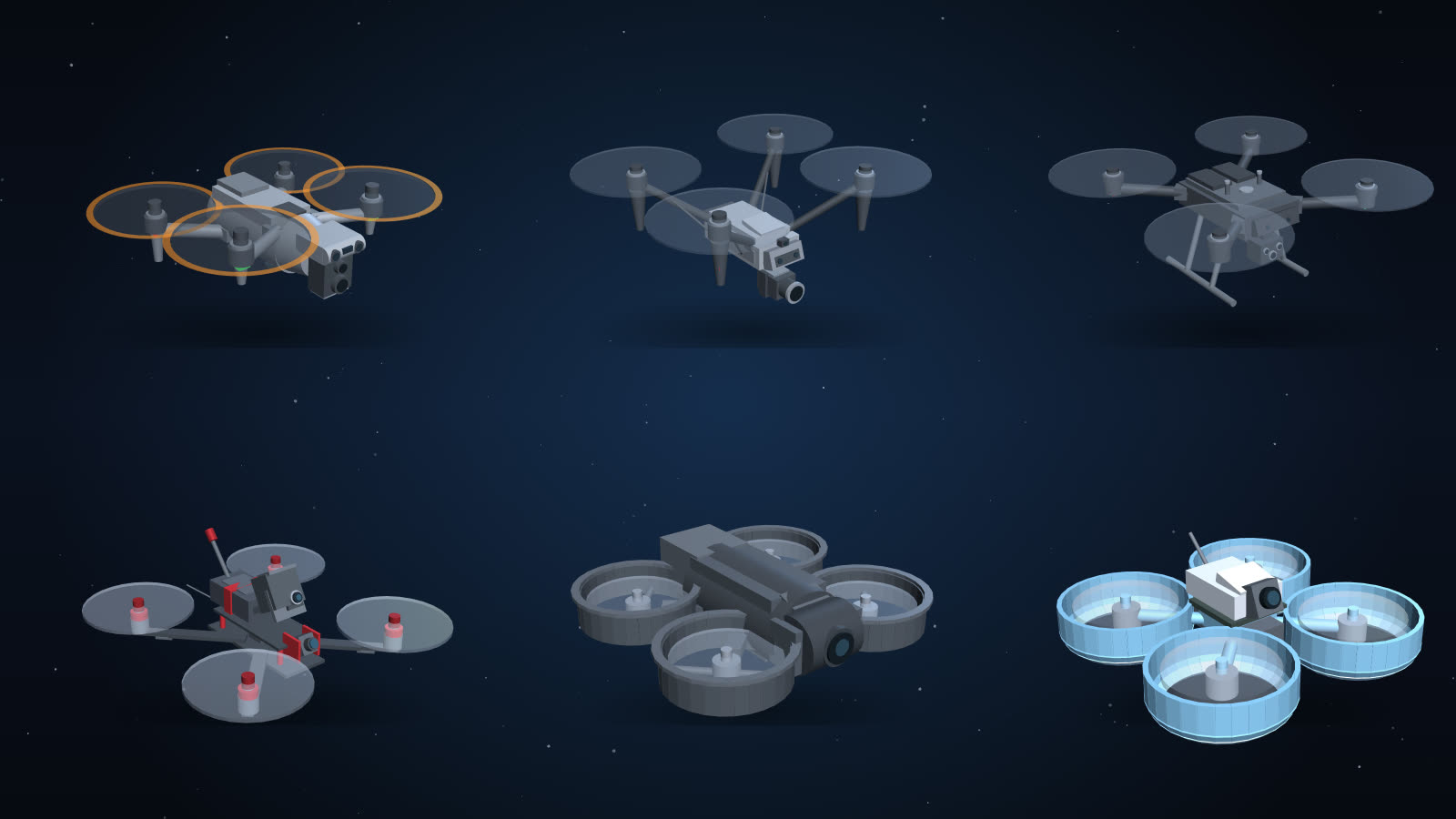
Choose from six drone looks

In the Display settings you can now pick how your drone looks: a compact camera drone, a cinema drone or an industrial drone, and a 5-inch freestyle quad, a cinewhoop or a micro whoop. It flies the same either way; only the look and the collision size change, so a micro whoop slips through gaps a cinema drone can't. The chase camera distance is adjustable too.

Six drone looks in Overfly: three camera drones and three FPV quads

Zoom, up to 7.6×

The onboard camera now zooms smoothly up to 7.6×. Press Z to zoom in and X to zoom out, or give zoom its own axis or switch on your radio. Short on switches? Hold one to turn your tilt control into zoom. Zoom out past 120° and the lens changes to the fisheye, with a short pause first so it never happens by accident. Zoom speed and tilt speed are both in the camera settings.

1-year licence · $34

Where are you flying first?

Coming soon